Maps & Views of London and Environs
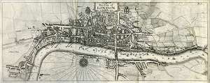 |
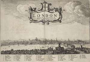
London ca. 1558–1603Title: The City of London as in Q. Elizabeth's Time |
 |
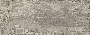
London ca. 1553–9Title: Londinum Feracissimi Angliae Regni Metropolis |
 |
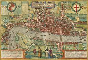
London 1553–9Title: Civitas Londinum |
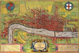 |
London ca. 1560Title: Londinum vulgo London |
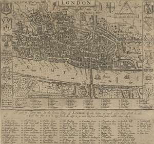 |
City of London 1593Title: A Guide for Cuntrey Men. In the famous Cittey of London |
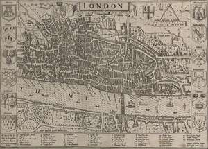 |
City of London 1593Title: London |
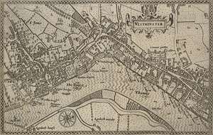 |
Westminster 1593Title: Westminster |
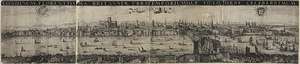 |
Prospect of London ca. 1600Title: Londinum florentissima Britanniae urbs |
 |
Prospect of London ca. 1600Title: London the glory of Great Britaines Ile |
 |
Prospect of London ca. 1600Title: Civitas Londini |
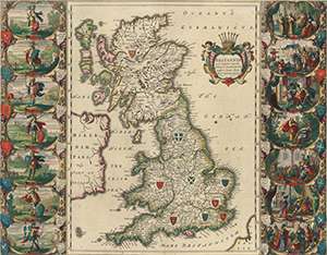 |
Britain, ca. 1640Title: Britannia Prout Divisa fuit Temporibus Anglo-Saxonum, Praesertim Durante Illorum Heptarchia |
 |
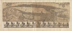
Prospect of London 1647Title: [London. The long view] Ad Londinum epitomen & ocellum |
 |
London 1658Title: London |
 |
West Central District of London ca. 1660Title: Bird's-eye plan of the west central district of London |
 |
London 1666Title: A Generall Map of the whole City of London with Westminster & all the Suburbs |
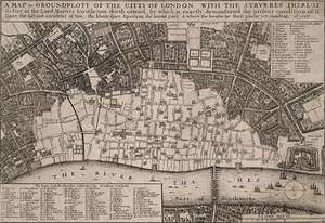 |
City of London 1666Title: A Map or Groundplott of the City of London, with the Subyrbes Thereof |
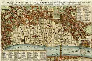 |
City of London 1666Title: A Plan of the City and Liberties of London after the Dreadful Conflagration in the Year 1666 |
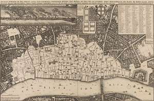 |
City of London 1666Title: An Exact Surveigh of the Streets Lanes and Churches Contained Within the Ruines of the City of London |
 |
City of London 1666Title: An Exact Surveigh of the Streets, Lanes, and Churches, Commrehend.d. Within The Ruins of the City of London |
 |
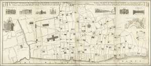
City of London proposal 1666Title: A Plan of the City of London, after the great Fire in the Year of our Lord 1666, with the Modell of the New City, according to the Design, and Proposal of Sr. Christopher Wren Kt. |
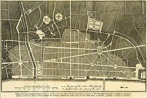 |
City of London proposal 1666Title: A Plan of the City of London, After the Great Fire in the Year of Our Lord 1666, According to the Design & Proposal of Sir Christopher Wren, Kt. for Rebuilding it |
 |
Prospect of London 1666 - hand colouredTitle: A True and Exact Prospect of the Famous Citty of London from S. Marie Overs Steeple in Southwarke |
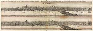 |
Prospect of London 1666Title: A True and Exact Prospect of the Famous Citty of London from S. Marie Overs Steeple in Southwarke |
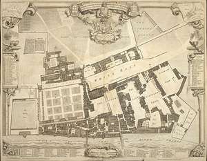 |
Survey & Ground Plot of the Palace of Whitehall 1670Title: A Survey & Ground Plot of the Royal Palace of White Hall with the Lodgings and Apartments belonging to their Majesties |
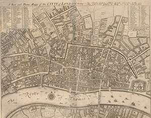 |
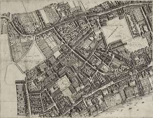
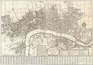
The City of London 1676Title: A New and Plaine Mapp of the Citty of London shewing the Streets Lanes Alleys Courts Churches Halls and other remarkable places as they are now rebuilt |
 |
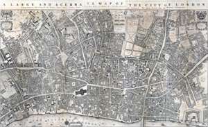
London 1677Title: A Large and Accurate Map of the City of London (facsimile) |
 |
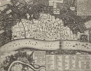
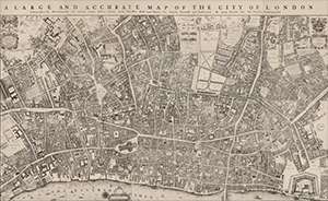
London 1677Title: A Large and Accurate Map of the City of London |
 |
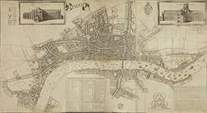
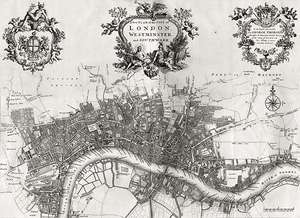
London and Westminster 1682Title: London &c. actually surveyed, by Wm. Morgan, his ma[jes]ties cosmogr., 1681/2 |
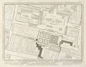 |
Covent Garden 1690–1790Title: Plan of Bedford House, Covent Garden, &c. taken down about 1690 from a drawing in the possession of John Crowle |
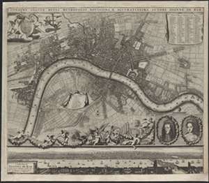 |
London, 1690?Title: Londini Angliæ regni metropolis novissima & accuratissima |
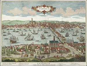 |
London ca. 1700Title: Londinum Urbs Praecipua Regni Angliae [London, the Principal City of the Kingdom of England] |
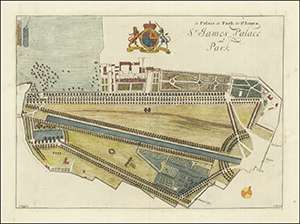 |
St. James Palace and Park 1707Title: le Palais et Park de St. James |
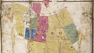 |
Marylebone 1708Title: Marylebone |
 |
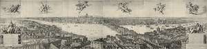
Prospect of London 1710Title: London |
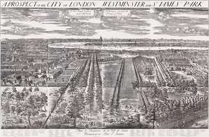 |
London, Westminster, and St. James Park 1710-1720Title: A Prospect of the City of London, Westminster and St. James's Park |
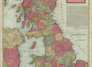 |
Great Britain ca. 1719Title: A New Map of Great Britain: According to the Newest and Most Exact Observations |
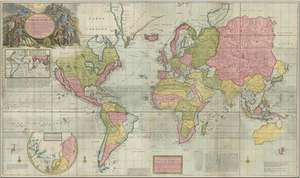 |
Map of the Whole World, 1719Title: A New & Correct Map of the Whole World Shewing ye Situation of its Principal Parts ... With the most Remarkable Tracks of the Bold Attempts which have been made to find out the North East & Northwest Passages. ... 1719 |
 |
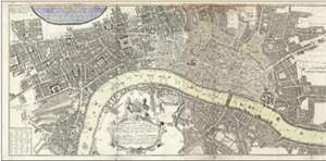
London, Westminster, and Southwark 1720Title: A New Plan of the City of London, Westminster, and Southwark |
 |
Great Britain ca. 1720–29Title: A new map of Great Britain: according to the newest and most exact observations |
 |
Map and Prospect of London, Westminster, and Southwark ca. 1725Title: Actuale Survey of London Westminster Southwark |
 |
London, Westminster, and Southwark 1735Title: A new and exact plan of the city's of London and Westminster, the borough of Southwark |
 |
Urbium Londini et West Monasterii nec non Suburbii South warkTitle: Urbium Londini et West Monasterii nec non Suburbii South wark |
 |
London, Westminster, and Southwark 1736Title: London surveyed or a new map of the cities of London and Westminster and the borough of Southwark... |
 |
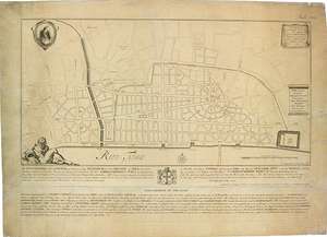
Plan of the Savoy 1739Creator: drawn by C. Lempriere |
 |
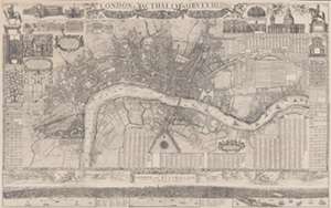
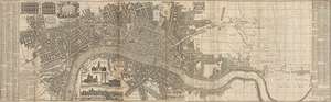
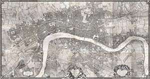
The Cities of London and Westminster 1741–5Title: An Exact Survey of the City's of London and Westminster ye Borough of Southwark and the Country Near Ten Miles Round Begun in 1741 & Ending in 1745 |
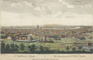 |
View of London ca. 1746Title: A North View of London |
 |
London 1746Title: A plan of the cities of London and Westminster, and borough of Southwark |
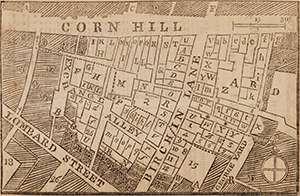 |
Exchange Alley, Cornhill 1748Title: Plan of the late Fire in Cornhill |
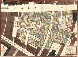 |
Exchange Alley, Cornhill 1748Title: A New & Correct Plan of all the Houses destroyd and damaged by the FIRE which began in Exchange-Alley,-Cornhill, on Friday, March 25th, 1748 |
 |
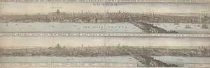
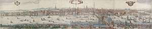
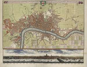
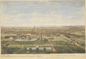
Prospect of London 1749Title: A long view of London and Westminster from the new bridge at Westminster to the Tower |
 |
View of London 1752Title: The north prospect of London taken from the Bowling Green at Islington |
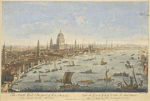 |
View of London 1752Title: The south west prospect of London from Somerset Gardens to the Tower |
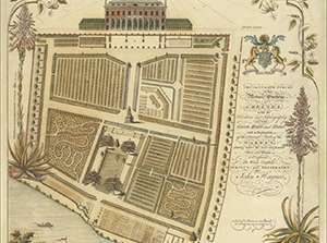 |
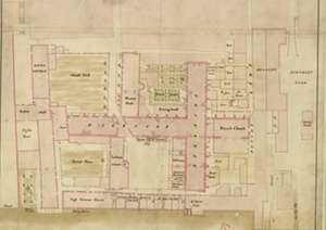
The Botanic Gardens at Chelsea 1753Title: An Accurate Survey of the Botanic Gardens at Chelsea with the Elevation and Ichnography of the Green House and Stoves, and an Explanation of the Several Parts of the Garden, shewing where the most conspicuous Trees and Plants are Disposed |
 |
London, Westminster, and Southwark 1761Title: A New and Correct Plan of London, Westminster and Southwark, with several Additional Improvements, not in any former Survey |
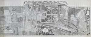 |
Topographical Survey of the Parish of Kensington 1766Title: A Topographical Survey of the Parish of Kensington with Plans and Elevations of the Royal Palace and Gardens, Hyde Park and Knightsbridge |
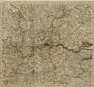 |
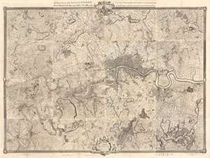
London and Environs 1773Title: A Mapp of the Countries Thirty Miles round London: Drawn & Engraved From Accurate Surveys |
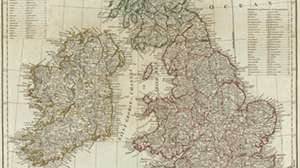 |
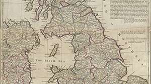
Great Britain and Ireland, 1788Title: A compleat map of the British Isles, or Great Britain and Ireland with their respective roads and divisions |
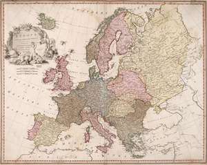 |
Europe, 1791Title: Europe, exhibiting its principal states, &c. |
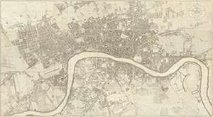 |
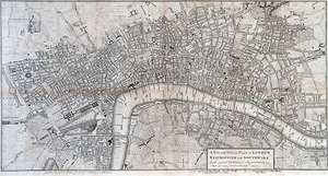
London, Westminster, and Southwark 1799Title: Plan of the Cities of London and Westminster, the Borough of Southwark and Parts Adjoining Shewing Every House |
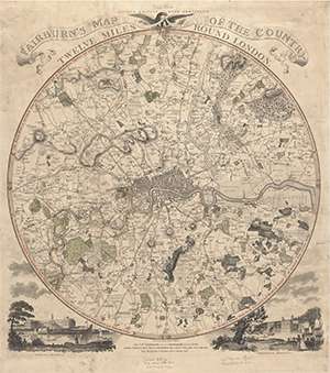 |
London and environs 1800Title: Fairburn's Map of the Country Twelve Miles Round London |
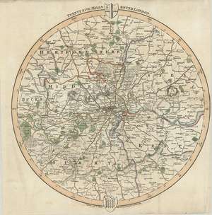 |
London and environs 1806Title: Twenty-five Miles Round London |
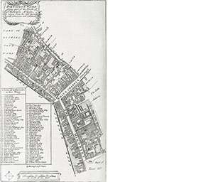 |
Map of Portsoken Ward (Strype, 1720)Title: Portsoken Ward being part of the Parish of St. Buttolphs Aldgate |
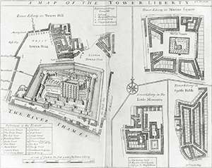 |
Map of The Tower Liberty (Strype, 1720)Title: A Map of the Tower Liberty |
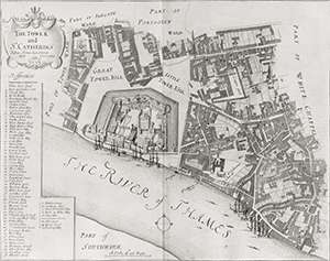 |
Map of The Tower Liberty and St. Catherines (Strype, 1720)Title: The Tower and St. Catherins |
 |
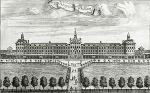
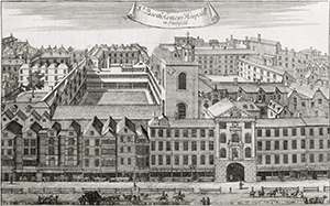
View of Bethlehem Hospital (Strype, 1720)Title: The Hospitall call'd Bedlam |
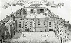 |
View of Bridewell (Strype, 1720)Title: The Prospect of Bridewell |
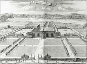 |
View of Chelsea College (Strype, 1720)Title: Chelsea College |
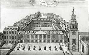 |
View of Christ Hospital (Strype, 1720)Title: Christ Hospital |
 |
View of Hoxton Hospital (Strype, 1720)Title: Hoxton Hospitall |
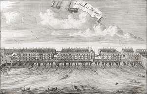 |
View of London Bridge (Strype, 1720)Title: London Bridge |
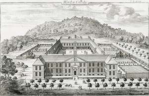 |
View of Morden College (Strype, 1720)Title: Morden College |
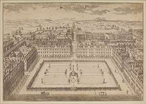 |
Bird's Eye View of Soho Square ca. 1725Title: Sohoe or Kings Square |
 |
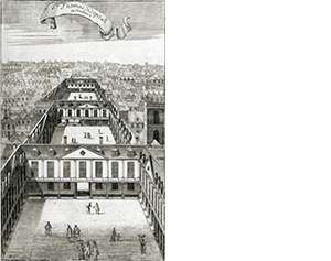
View of St. Bartholomew's Hospital (Strype, 1720)Title: St. Bartholomew's Hospitall in Smithfield |
 |
View of St. Thomas Hospital in Southwark (Strype, 1720)Title: St. Thomas Hospitall in Southwark |
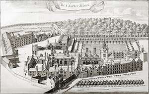 |
View of the Charter House (Strype, 1720)Title: The Charter House |
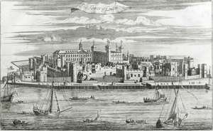 |
View of the Tower of London (Strype, 1720)Title: The Tower of London |
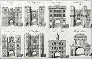 |
The Gates of London (Strype, 1720)Title: The Gates of London |